Homeless Ad Hoc Committee tonight

The first meeting of the city’s Homeless Ad Hoc Committee is tonight:

AGENDA
WEDNESDAY, JANUARY 30, 2019 5:00 p.m. – 7:00 p.m.

CITY COUNCIL CHAMBERS
CITY HALL NORTH, SECOND FLOOR OCEANSIDE, CALIFORNIA 92054

  1. Call to Order / Roll Call
  2. Focuses and Goals of the Homelessness Ad-Hoc Committee
    Michelle Gomez, Housing Commissioner and Homelessness Ad-Hoc Committee Chairperson
  3. Homelessness in Oceanside and the Greater Region
    Presentation by Frank McCoy, Police Chief, City of Oceanside
  4. Regional Services Currently Available to Homeless Community Members
    Presentation by Greg Anglea, Chief Executive Officer, Interfaith Community Services
  5. Working Collaboratively to Avert and Develop Solutions to Homelessness
    Presentation by Anthony White, Associated Student Government Vice President, Palomar College
  6. Public Communications
    There is a three-minute time limit for all persons addressing the Ad-Hoc Committee.
  7. Adjournment

    The next scheduled public Homelessness Ad-Hoc Committee meeting will convene at 7:00 p.m. on February 26, 2019 in City Council Chambers (City Hall North, Second Floor).


The Housing Commission’s ad hoc committee on the Homeless was created in November 2018 “to examine the causes of homelessness and develop and recommend sustainable solutions to address homelessness in our community.”

Its members are:

  • Four Housing Commission members:
    • Commissioner Michelle Gomez (chair of the Housing Commission and chair of the ad-hoc committee)
    • Commissioner Linda Walshaw
    • Commissioner Eileen Costa
    • Commissioner Rafe Trickey

  • Ward O’Doherty, Oceanside Economic Development Commission
  • Jordy Spark, Oceanside Unified School District
  • Alisha Eftekhari, Behavioral Health Services in the North Coastal Region
  • Piedad Garcia, County of San Diego

San Diego’s plans to increase housing density

In his January 15 state of the city address, San Diego’s mayor Kevin Faulkner proposed to increase building heights and housing density and reduce parking requirements in transit-intensive areas — notably along the $2.1 billion Mid-Coast Trolley Extension from Old Town through Claremont and University City to UCSD. Below are excerpts of expert reaction published Sunday.

UT-Economists
Do You Think the Mayor’s Housing Plan Will Work?

San Diego Union-Tribune, January 27, 2019, p. 2

David Ely, Economist, San Diego State University

YES: Eliminating restrictions on building height and parking in some areas of the city will allow for more units to be profitably built so these steps could contribute toward easing the housing shortage. Unfortunately, the proposed changes are only a partial solution. They will not help expand housing for everyone who does not want to live in high density areas near public transportation or in parts of the county outside the city of San Diego.

Chris Van Gorder, CEO, Scripps Health

NO: I don’t think it will work. Building high density housing without consideration for parking needs would require both a culture of using mass transit along with readily available mass transit and we have neither. This might work in just a few areas like downtown but could not be used in most locations without negative results. The mayor’s plan is commendable in its intent, but perhaps too audacious.


Tuesday’s STR hearing

Tuesday (from 3-6 p.m.) is the final hearing of three for the city’s ad hoc committee on Short Term Rentals. The handout can be found here and details on the hearing are shown below.

The city’s report again reiterates that the greatest impact of STRs on Oceanside residential neighborhoods is west of I-5, i.e. in South O (South of Oceanside Blvd.)‚ and in Townsite (north of the Boulevard). Here we summarize some of the issues to be discussed Tuesday.

STR South O 6-22-18

Cap on STRs

The AHC members (3 of the 7 planning commissioners) asked the city staff to investigate the idea of a cap on STRs. The staff identified three options:

  1. Citywide cap
  2. Cap on STRs in single-family zoning districts west of Interstate 5: 
    • With approximately 75% of the registered STRs located in the coastal zone, neighborhoods west of Interstate 5 have a greater concentration of STRs. If the AHC were to pursue a cap on STRs in certain residential zoning districts, staff suggests the cap only apply to new STRs located in single-family districts (R1, RS, or RE Districts) located west of Interstate-5.

  3. Concentration or separation standards per zoning district or neighborhood planning area: “The AHC could recommend a maximum concentration of STRs in each zoning district or neighborhood planning area.”

The staff does not favor a cap “at this time,” but instead would prefer to have the STR problem get worse before stricter regulations are imposed.

AHC Proposals Moving Forward

The staff has proposed starting from the 2016 Good Neighbor Policy and the AHC has largely agreed.

One key element of that is limiting occupancy to two residents per room (formerly two adults) plus two other residents. (Encinitas has 2 per room plus 1). At this meeting, the AHC and staff will discuss the minimum definition of a “bedroom.”

Other Differences Between Staff and AHC

  • Special events. The AHC suggested banning them, while the staff proposed allowing a combination of the sleeping cap plus “less than 10 guests”.
  • Parking. The AHC asked that STRs provide all parking onsite (as in the Encinitas STR ordinance), but staff opposes this because it “poses an equity issue.”
  • Blanket Exemptions. A majority of the AHC favorited regulating all STRs, while the staff “Staff favors offering permit exemptions for hosted STRs as well as STR properties that are part of HOAs that are physically self-contained and provide 24-hour on-site management” such as North Coast Village and St. Malo.
  • Notification of Neighbors. A majority of the AHC asked that neighbors be notified when an STR permit is sought, while the staff propose an online database listing STRs.
  • Minimum Night Stay. The AHC previously supported a 3-night minimum stay, while the staff argues for a 2-night stay.

Subject:             3rd STR Ad Hoc Committee Meeting: January 29th 3-6pm
Date:     Wed, 23 Jan 2019 23:24:31 +0000
From:    Shannon Vitale <SVitale@ci.oceanside.ca.us>

Dear Interested Party,

The third and final Short Term Rental (STR) Ad Hoc Committee Meeting to discuss policy recommendations regarding the regulation STRs will be held next Tuesday (January 29th) from 3pm to 6 pm in the City Council Chambers.  Please note that public testimony is scheduled at the beginning of the meeting.

Here is a link to the agenda packet (including the agenda, staff report and attachments): https://www.ci.oceanside.ca.us/civicax/filebank/blobdload.aspx?BlobID=48949

Please let me know if you have any questions or if you would like to submit comments prior to the meeting.

Thank you for your interest and participation in this process!

Best,

Shannon

Shannon Vitale, Planner II
City Of Oceanside
Development Services Department
300 N. Coast Highway
Oceanside, CA 92054
760-435-3927
http://www.ci.oceanside.ca.us


All voicemail to and email to and from the City of Oceanside may be considered public information and may be disclosed upon request.

La Tuna Canyon Fire

Saturday’s Wall Street Journal article mentioned how the road diet in the Sunland-Tujunga area impaired evacuation during the September 2017 La Tuna Canyon fire, which (at 7,194 acres) was the largest fire since 1961 within the city of Los Angeles.

After the fire, the community asked that the road diet be eliminated:

North Valley Reporter

Sunland-Tujunga Takes Vision Zero “Road Diet” Position

By Nina Royal | on September 14, 2017

After over an hour of comments and discussion with the community and Daniel Mitchell, Assistant General Manager, Los Angeles Department of Transportation, the board of the Sunland-Tujunga Neighborhood Council (STNC) voted the following letter to be sent to the City. Letter written by Pat Kramer, STNC Region 1 Representative. The letter has since been supported by the Shadow Hills Property Owners Association (SHPOA).

“On behalf of the stakeholders in Region 1, the community of Sunland-Tujunga and in reaction to over 1000 petition signers throughout our local Foothill communities;

The Sunland-Tujunga Neighborhood Council requests that the Department of Transportation and all agencies related to traffic control in the City of Los Angeles, be notified to immediately remove the bollards and barriers starting at Foothill Boulevard by Sunland Park going west to Wentworth Street, with complete restoration of two lanes of traffic in either direction.

These recommendations come after experiencing the recent La Tuna Canyon firestorm which closed down the 210 Foothill Freeway at Sunland Boulevard for days and forced tens of thousands of motorists onto a single lane in either direction East & West on Foothill Boulevard while thousands of residents were fleeing their homes due to mandatory evacuations.

Based on the extreme difficulties caused by the reduction of lanes on our only main thoroughfare from the installation of seldom-utilized bike lanes; and taking into account the hours of delays and gridlock traffic caused by the lane reductions during this emergency disaster; and based on how these very concerns were expressed to our City officials and Department of Transportation reps when the lane reductions took place earlier this year – specifically, our concerns about how the single lanes would cause gridlock to motorists and impact our emergency services in a disaster; and based on the occurrences of at least three traffic accidents in this same area of Foothill Boulevard during the fire as motorists were trying to get out quickly we are requesting immediate action.”

It will now be forwarded to all of the entities to try to get this problem corrected. if you were not at the meeting, you can forward your comments to CD7 Councilperson Monica Rodriguez: eve.sinclair@lacity.org or to DOT Asst. General Manager Daniel Mitchell at: dan.mitchell@lacity.org.

A ‘Road Diet’ Fad Is Proving to Be Deadly

From the Wall Street Journal op-ed section, January 19, 2019:

Vision Zero, a ‘Road Diet’ Fad, Is Proving to Be Deadly

Emergency vehicles get stuck on streets that have been narrowed to promote walking and bicycling.

By Christopher D. LeGras
Jan. 18, 2019 6:17 p.m. ET
Renee Khoury was in the kitchen when she heard a scream. She ran outside and found her 65-year-old mother, Rebecca, sprawled on the sidewalk with a compound fracture in her left leg. Renee called 911 then comforted her mom as best she could.The Khourys live five blocks from Fire Station 62 in West Los Angeles’s Mar Vista neighborhood. They heard a siren right away, but something was wrong. It wasn’t moving. “It took 10 minutes,” says Renee’s husband, Jeff. “Becky was in pain. They could hear help but it couldn’t reach them.”

Los Angeles, like cities nationwide, is transforming its streets. In July 2017 the city installed a “road diet” on a 0.8-mile stretch of Venice Boulevard in Mar Vista, reducing four lanes to two and adding bike lanes separated from traffic by parking buffers. The project is part of Mayor Eric Garcetti’s Vision Zero initiative, which aims to eliminate traffic fatalities in the city by 2025. Launched in 2015, Vision Zero is the most radical transformation of how people move through Los Angeles since the dawn of the freeway era 75 years ago.

By almost any metric it’s been a disaster. Pedestrian deaths have nearly doubled, from 74 in 2015 to 135 in 2017, the last year for which data are available. After years of improvement, Los Angeles again has the world’s worst traffic, according to the transportation research firm Inrix. Miles of vehicles idling in gridlock have reduced air quality to 1980s levels.

The international Vision Zero movement began in the 1990s in Sweden, where it apparently worked well. The Swedish government claims a 50% reduction in traffic deaths since 2000. Hoping to achieve similar gains, U.S. mayors from New York City to North Pole, Alaska, have adopted Vision Zero. Projects range from multibillion-dollar light-rail lines to retiming traffic lights for slower traffic. Road diets are key.

In neighborhoods across New York City, residents, community boards and local businesses have done battle with city officials over “traffic calming” measures imposed by city hall. Lane reductions, bike lanes, new meridians and other innovations designed to reduce vehicle speeds make it difficult for bulky ambulances and fire trucks to respond quickly to emergencies. And while pedestrian deaths have plummeted in the Big Apple under Vision Zero, deaths of bicyclists, motorcyclists and people in vehicles have ticked up.

Around the country, officials have implemented projects on short notice, over local objections and without consulting first responders. Howard Holt, a fire captain in Oakland, Calif., said he found out about a road diet in front of his station when he arrived for a shift one morning. “I wasn’t sure if I was supposed to drive in the new green lanes,” he said recently. “Turns out they’re bike lanes.” He calls the city bureaucracy “The Wall.”

During the 2017 La Tuna Fire, the biggest in Los Angeles in half a century, a road diet on Foothill Boulevard the in Sunland-Tujunga neighborhood bottlenecked evacuations. After the fire a neighborhood association voted to go off the road diet. The city ignored the request and instead added another one to La Tuna Canyon Road.

The story isn’t confined to big cities. In Waverly, Iowa (pop. 9,837), Fire Chief Dennis Happel and Bremer County Sheriff Dan Pickett say the city has ignored their concerns over a road diet plan. In Fairbanks, Alaska, Fire Battalion Chief Brian Davis says the city installed traffic controls to mitigate the impact of new bike lanes in front of his fire house. In January the average high temperature in Fairbanks is zero Fahrenheit—much too cold to ride a bike.

It’s noble to want to make America’s streets as safe as they can be. But government officials shouldn’t impose projects on communities that don’t work, inconvenience residents, hurt businesses and impede emergency responders in the process.

Mr. LeGras is an attorney and writer in Los Angeles.

Appeared in the January 19, 2019, print edition.


Voicing your opinion on Coast Highway

Today was the deadline for comments on the November 2018 EIR. However, the final decision about the Coast Highway “road diet” (4 lanes to 2) and development incentives will be made by the city council (most likely in Spring 2019).

We have lots of detailed information about the Coast Highway plan on our website. We would also be glad to answer any questions via email, or have a speaker come out and talk to a neighborhood or community group.

Please also contact us if you’d like to be on our email list for future updates.

Coast Hwy: impact on South O neighborhoods

Little understood is the impact that the city’s proposed development incentives will have on South O. It turns out this increased density will dump more traffic into South O residential neighborhoods between Coast and Interstate 5, according to a new analysis of the city’s numbers.

South O residents have mobilized against the proposed “Road Diet”, reducing Coast from 4 lanes to 2 despite Coast Highway being too busy under federal guidelines for a road diet.

However, the impact of the increased density is buried in the 4,700 pages of the July 2017 and November 2018 EIRs. (Note: Monday 5pm is the deadline for comments on the latter). We have previously noted that having development incentives south of Morse Street would change the character of the business district. Particularly troubling is demolishing the block formerly owned by the Blade-Tribune (aka North County Times) at Cassidy and Coast, for a “transit-oriented node” that is no where near any real mass transit.

Dumping Traffic Into Neighborhoods

The development incentives would increase density along Coast Highway. For the highest density zoning, this would mean residential housing on 3-6 upper floors. The plan envisions increasing apartments/condos on the Coast Highway corridor by 9x (from 621 to 5,871 units) and hotel rooms 7x (from 425 to 3,074 rooms).

morse st arrows
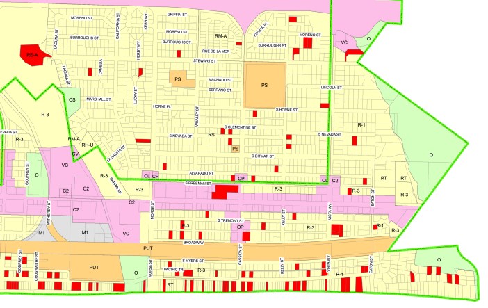
What does that mean for South O? Let’s look at the traffic projections for one intersection, Coast and Morse Street.

With or without changes, there will be considerable northbound and southbound traffic through this intersection. At the evening rush hour, today Morse  is the 4th busiest intersection on Coast (after Vista Way, Oceanside and Cassidy).

However, what is not so obvious is how the development incentives increase the traffic entering/leaving the intersection from the residential neighborhoods to the east. Here is what the relevant diagrams (Fig 4-1,5-5,5-7,5-9) say about the hourly traffic at evening rush hour in 2035 with three of the four alternatives:

Westbound Eastbound Total Traffic
Existing (2013) 114 156 1,679
Alternative 1 232 319 2,149
Alternative 2 232 319 2,149
Alternative 3 322 443 1,911

In other words, Alternatives 1 and 2 double the traffic onto Morse, and Alternative 3 triples the traffic (No traffic models were done for #4). The differences are driven by the incentive districts.

The city’s Alternatives 1,2,3 all have an incentive district: citywide for #1 and #2, and from Harbor to Morse St. for #3. In terms of road diet, #1 stops at Oceanside Blvd., while #2 and #3 extend south to Morse.

Alternative #3 (stopping diet and incentives at Morse) was proposed by the council as a compromise — and an alternative to what the community asked for (stopping both at Oceanside Blvd.) which was not studied. By this this measure, it is worse not better than the other alternatives.

Here is the raw data from Figure 4-1 and 5-9, which report actual data from 2013 and projected 2035 data for Alternative 3:


Providing Feedback

Residents have until 5pm Monday January 14 to provide feedback on the completeness of the EIR in assessing the environmental, traffic and economic impacts of the alternatives on South O and other parts of Oceanside. For example, the city still has not released data from more than two years of the “temporary” road diet between Oceanside and Morse.

At Save South O, we believe the residents and merchants of South O still overwhelmingly favor no road diet and no development incentives South of Oceanside Blvd. To avoid confusion, we encourage those contacting city to explain their position in these terms.

Feedback on the EIR should be sent to John Amberson (JAmberson@ci.oceanside.ca.us) by 5pm January 14.

Residents may also want to send their feedback to the city council at Council@ci.oceanside.ca.us

Now that the council is back to five votes, the city council is expected to vote to select one of the Coast Highway alternatives (or no project) at a council meeting in Spring 2019. We will keep South O posted on all developments between now and then.

Why a Road Diet won’t work in South O

The city is nearing a  final decision about the “Road Diet”, its proposal to shrink some or all of Coast Highway from 4 lanes to 2 lanes. This is a project that’s been discussed and studied for more than a decade.

Traffic Circle-LargeToday the city is considering four Alternatives (see here), all of which include a Road Diet with roundabouts. Alternatives 1-3 also include development incentives that could increase residential units 9x and hotel rooms 7x. In July 2017, the city issued a 2,309 page Environmental Impact Report studying Alternatives 1,2,4. In November 2018, it issued a 2,406 page supplemental EIR that studied its new Alternative 3; feedback on the 2018 EIR is due by January 14.

However, neither of the city’s EIRs acknowledge the official “Road Diet” guidance of the Federal Highway Administration (FHWA), as reflected by its November 2014 Road Diet Information Guide. The guide has been available on their website since then, but it is not mentioned in either EIR. According to the Federal guidelines, the existing (and future) traffic levels on Coast Highway are too great for a Road Diet to work here.

What the Guide Says

After reviewing the history of Road Diets over the past 40 years, the FHWA guide talks about the reasons for a diet (Ch. 2), whether a local context is suitable (Ch. 3), how to design a diet (ch. 4) and to measure its success (ch. 5). Only 3 paragraphs of the 72 pages discuss roundabouts; one paragraph recommends against introducing a road diet with roundabouts at the same time due to potential public opposition.

Section 3.3 talks about the operational factors that make a diet suitable or not suitable, based on vehicles per day (VPD) and vehicles per hour per day (VPHPD):

3.3.5 Average Daily Traffic (ADT)

The ADT provides a good first approximation on whether or not to consider a Road Diet conversion. If the ADT is near the upper limits of the study volumes, practitioners should conduct further analysis to determine its operational feasibility. … The FHWA advises that roadways with ADT of 20,000 vpd or less may be good candidates for a Road Diet and should be evaluated for feasibility.

3.3.6 Peak Hour and Peak Direction

The peak hour volume in the peak direction will be the measure of volume driving the analysis and can determine whether the Road Diet can be feasibly implemented. …The Iowa guidelines suggest, from an operational point of view, the following volume-based Road Diet feasibility conclusions (assuming a 50/50 directional split and 10 percent of the ADT during the peak hour):

  • Probably feasible at or below 750 vehicles per hour per direction (vphpd) during the peak hour.
  • Consider cautiously between 750 – 875 vphpd during the peak hour.
  • Feasibility less likely above 875 vphpd during the peak hour and expect reduced arterial LOS during the peak period.

Finally, the guide also says that “Road Diets can cause some diversion of traffic to parallel routes.” In the original EIR, South O and Seaside residents both complained to the city that the Road Diet would cause frustrated drivers to leave Coast for streets paralleling Coast. The 750 vphpd standard means 1,500 vehicles/hour in both directons.

How This Applies to Oceanside

How does this apply to Oceanside? If you look at the November 2018 EIR, Coast Highway peak evening traffic is already above the FHWA’s peak recommended level for Oceanside Blvd. and points south.

Road Diet none to Oside Blvd to Morse to Morse
Incentives none all Coast all Coast to Morse
Year 2013 2035 2035 2035
Alternative Existing Alt. 1 Alt. 2 Alt. 3
Harbor & Coast 579 704 704 579
Mission & Coast 1,047 1,845 1,845 1,047
Wisconsin & Coast 1,379 1,422 1,422 1,379
Oceanside & Coast 1,638 1,570 1,570 1,638
Morse & Coast 1,510 1,847 1,847 1,510
Cassidy & Coast 1,572 1,646 1,646 1,572
Vista Way & Coast 1,664 1,947 1,947 1,664


Oceanside’s newest councilman: Ryan Keim

The mayor and three remaining council members voted tonight to appoint a new council member to serve the remainder of a 2 year at-large seat (expiring in 2020), vacated by the election of Esther Sanchez in November to the District 1 seat (expiring in 2022).

The council voted to appoint former Oceanside police officer Ryan Keim, age 36. According to a slide of the council preferences posted to “Wake Up, Oceanside,” Keim was the only candidate listed by all four council members:

  • Peter Weiss: Krista deBoer, Ryan Keim, Jerry Kern, Ward O’Doherty, Philip Schwartze
  • Jack Feller: Pam Weiss, Philip Schwartze, Jerry Kern, Mike Blessing, Ryan Keim,
  • Esther Sanchez: Jane Marshall, Marilou dela Rosa, Nichole Dominguez, Ryan Keim
  • Christopher Rodriguez: Stacy Thompson, Phillip Schwartze, Ryan Keim, Jane Marshall, Jerry Kern
ryan-keim-2016
2016 picture from OsideNews.com

He was not on the list of 28 applicants in Sunday morning’s story in the San Diego Union-Tribunte. He was also not mentioned in the Dec. 31 story in the San Diego Reader which predicted former chamber chairman Kevin Witowich would be appointed (Witowich later withdrew his application).

In 2016, Officer Keim was a spokesman for the Oceanside police department, and in 2017, he was media relations director for the county sheriff’s department.

At one point, Keim lived in the Southeast corner of Oceanside — south of Highway 78 — which today is in District 3. District 3 includes all of Oceanside south of Oceanside Blvd., including South O, Fire Mountain part of Rancho del Oro, Miracosta and all of Oceanside south of SR-78.


Economic impact of the “Road Diet”

The city’s proposed “Road Diet” proposes eliminating half of the trafic lanes lanes on Coast Highway, reducing Coast from 4 lanes to 2 from Oceanside Blvd. north to the Harbor. Of the four options, two options (Alternative 2,3) also narrow traffic lanes south to Morse Street, and one (Alternative 4) cuts it citywide, including all of South O.

Local businesses fear that the reduced access will put them out of business. However, the city has not released the data from its test “Road Diet”, nor does its latest EIR talk about the potential economic impacts of the road diet. (Comments on this EIR are due by 5pm January 14).

The 33 Month Pilot Study

For nearly three years — since March 31, 2016 — the city has experimented with a “temporary” road diet on Coast between Morse and Oceanside. At the time, city staff said the data would support the city’s proposed road diet citywide:

“I hopes this will prove we can do a two lane Coast Highway,” David DiPierro, city traffic engineer, said. “The public can see what a two lane Coast Highway would look like. If it does not work, as we intend it to work, we can revert back and study it more.”

When the “pilot program” was approved, the city said

[Scott] Smith said part of the pilot design would track changes in vehicles speeds and traffic patterns, including use of side streets.

A Traffic Measurement System would be installed in the study area between Oceanside Boulevard and Morse Street to measure vehicle travel time, speed and origin of destination. This would allow analysis of road changes on drivers’ commute times.

While the city has gathered the data, no report has been issued to the public. Individual council members have said they also have not received the data.

However, residents have experienced increased traffic congestion on this stretch between Oceanside and Morse, with traffic jams common on weekday afternoons and summer weekends. The city is aware of these effects.

coast-before
Coast Highway crossing Loma Alta Creek, before pilot project (Source: Bing Maps).
coast-after
Coast Highway crossing Loma Alta Creek, during pilot project (Source: Google Maps).

Studying Economic Impacts

When it comes to economic impacts, the November 2017 EIR only talks about the historic impacts of the Coast Highway, not the impact of the proposed changes. This phrase appears three times:

From the early to mid-20th century the Coast Highway was a major economic driver in the City of Oceanside and was largely responsible for the City’s growth from the 1920s through the 1950s.

Under the CEQA guidelines (14 CCR § 15131b in the California Code of Regulations) says

Economic or social effects of a project may be used to determine the significance of physical changes caused by the project. … Where an EIR uses economic or social effects to determine that a physical change is significant, the EIR shall explain the reason for determining that the effect is significant.

The discussion of economic impacts in the July 2017 EIR mainly focuses on the temporary disruption due to construction. However, it does say the proposal is consistent with the county’s strategy for increased residential density and reliance on alternative transit as a path towards “reduced congestion”:

Sustainable Communities Strategies

In October 2015 the San Diego Association of Governments (SANDAG) adopted the 2015 Sustainable Communities Strategies (SCS), which builds on the previous 2011 SCS and directs investments within existing urbanized areas to encourage growth within existing higher-density urban boundaries and discourages urban and suburban sprawl. Elements of the 2015 SCS that have been implemented include the completion of bicycle and pedestrian projects and the expansion of transit with new rapid bus service. The goals of the 2015 SCS include increasing the number of homes and jobs near transit, reducing transit travel time, and achieving economic benefits due to reduced congestion and the construction of transportation infrastructure, as well as reducing air pollutant emissions.

Potential Impacts

At the January 3 meeting hosted by Save South O, local businesses (particularly those in the dip) complained about the disruption of the existing (temporary) road diet, as well as the greater harm of reducing lanes and increasing density, potentially citywide.

The fear of negative impact on local businesses is real. In the eight months of the “road diet” on Venice Blvd. in Los Angeles, 15 businesses have closed their doors. The remaining businesses are struggling with angry and frustrated customers.

With only about 50 businesses in South O along Coast Highway, losing 15 businesses here would be very damaging both to the community and to business confidence in Oceanside more generally.