Our Neighborhood Voices: restoring local control

Save South O and other community groups around the state are circulating petitions to put the “Our Neighborhood Voices” initiative (also called the Brand-Huang-Mendoza Tripartisan Land Use Initiative) on the November 2022 state ballot. The goal of this is to stop recent efforts by Sacramento politicians to usurp local land use decisions, forcing cities to accelerate property development without regard for local conditions or concerns.

The grassroots support for this measure makes it almost certain it will qualify, but that’s just the beginning of the battle. Local neighborhoods and cities will be outspent 10:1 or even 100:1 by developer interests who will distort the bill as anti-housing or who knows what other lies. Thus, we will need to go door to door to make sure every voter in our city understands what this fight is about and why this measure is essential.

We plan to start signature gathering later this month, so if you are interested, please contact us directly.

Continuing fight against 1602 S. Coast

This weekend marks the latest round in the fight against 1602 S. Coast Highway, a proposed 54-unit, 42′ tall condo project that with traffic, density, parking and height would permanently change the character of South O (and set a precedent for other projects to do so):

  • On Saturday, there is a rally at Marshall Street Park from 10am – noon. Residents will be making signs for the PC hearing. Save South O will be selling t-shirts at cost ($5/each) so residents can clearly signal at the hearing what side they are on.
  • At 6pm Monday, this will return for a second time to the Planning Commission. While people can watch on Zoom or KOCT, under new city policies, only those present at the council chambers (300 N. Coast Highway, Oceanside) will be allowed to testify.

Sept. 27 PC Hearing

We had a good turnout of South O residents at the Sept. 27 hearing, both in person and online. The community members made strong arguments (summarized here) about why the project is not appropriate for South O, and needs to be sent back for changes to reduce its impact.

South O residents living nearby talked about the existing traffic and pedestrian safety issues that will be exacerbated by this 54-unit project, as well as the impact of a 42′, 4-story building looking down on their homes. Others focused on how it is under-parked, and that everyone in the room knew that — despite the parking/density bonuses of being a half mile from the Sprinter station — the residents will have more cars than parking spaces and will spillover into neighborhood streets.

But fundamentally, a majority of the PC agreed that this project is not consistent with the character of the local community. As Oceanside’s 1985 Local Coastal Program Land Use Plan (p. 34) states:

The Coastal Act requires that the visual qualities of the Coastal Zone shall be protected and that new development be sited and designed to be visually compatible with the character of surrounding areas.

On Sept 27, the PC leaned 3-1 to send the plan back for revision. However, the city planner used a procedural move to create a tied vote so that it could be reconsidered on Oct 11 (this Monday) when more PC members would be present. These PC members have not heard the testimony from Sept 27, and the one commissioner (Louise Balma) appeared to be on the fence while two (Robin Goodkind, Jolene Hayes) were opposed and the fourth (Tom Morissey) strongly supported it.

Going Forward

The developer and its land use consultant have made clear that they have no intention of negotiating any substantive changes with the city — over density, scale or parking — unless forced to do so by the city. If they lose on Monday, their clear plan is to take the existing project to the council and demand that it approve the project. That council meeting would likely be in November or early December.

Similarly, if South O loses on Monday, we will ask the council to hear our appeal. The stakes in this project are too high, as having a wall of such projects along Coast Highway would clearly destroy the unique character of South O. Other projects are in the pipeline, waiting to see what happens on this project and the maximum density they can cram into their planned projects.

We ask all South O residents to attend in person, email comments in advance (by noon Monday) to PlanningCommission@oceansideca.org, or both.

Massive condo project at PC Monday

For almost five months, South O residents have been fighting plans for a massive (and unprecedented) condo project at 1602 S. Coast (SE corner of Morse and Coast). It comes before the Planning Commission Monday at 6pm: the public can participate in person, via zoom, phone or emailed comments.

This project has unprecedented scale and density for any South O development on Coast Highway. If the Planning Commission follows the staff recommendation, this project will set a precedent to change permanently change the character of South O.

Summary

The staff report is recommending approval of the 54 unit project at the SE corner of Morse and Coast Highway. The report says that the developer, Hallmark Development of Solana Beach, held outreach meetings with the community, which it did (via Zoom) on April 14 and May 4.

What it doesn’t say is that the developer made no substantive changes to the areas where South O residents fiercely objected: height, scale, density and inadequate parking.

Unprecedented Height

The staff report claims

This proposed development would be compatible with surrounding developments in terms of land use, density, and lot size. The proposed four (4) story mixed use development is consistent with many of the existing and proposed mixed~use developments along South Coast Highway. The existing developments within the neighborhood range from one to two-story single-family and two to three story multi-family complexes, commercial and office developments.

In other words, a new 4 story, 42′ tall condo project is “compatible” with the neighborhood.

  • Of all the commercial development on Coast Highway from Morse Street to the city limits, there is exactly one building taller than two stories: the portions of the abandoned Blade-Tribune building near Cassidy St. So there is no precedent for a 4-story, 42′ building.
  • The residential development east of Coast between Morse and Cassidy is 1- and 2-story single family homes and apartments. The proposed project will dwarf and shadow this neighborhood unlike any others.

Unprecedented Density

The report says the Morse Street Townhomes (north of Morse, east of Coast) sets a precedent for this project.

The Morse Street Townhome project located directly north from the project site along Morse Street was recently developed as a three-story condominium project and is similar in terms of density, scale, and architectural features

However, a cursory comparison of these two projects shows that the new project has unprecedented density (more than 3x as large) and scale (both in terms of height and lot coverage):

Morse Street Townhome1602 S. Coast
Area2.3 ac0.9 ac
Height34.5′42.0′
Stories3 plus roof deck4 plus possible deck
Units3854
Density16.5 du/ac59 du/ac
Commercial03,300 sq ft
Parking83 spaces77 spaces
Lot coverage33%86%

The report also claims that “the proposed development … is consistent with the goals of the Coast Highway Corridor Study and Coast Highway Vision and Strategic Plan.”

However, the use of a project north of Morse is a red herring. The staff knows full well that while the 2007 Coast Highway Vision called for increased density along Coast, when the council voted in August 2019 to enact that vision, it voted to eliminate density and development incentives from all property south of Morse Street. So city development policy North of Morse is different from that South of Morse. (Just as development policy West of Coast is different from that East of Coast).

Inadequate Parking

The project has 34 2BR units, 20 3BR units and 64 residential parking spaces. In addition it has 11 spaces for commercial use and 2 guest parking spaces.

According to the April 14 community meeting, developer is expecting to sell these condos for $600-800k. However, it is claiming that the residents won’t own as many cars as elsewhere in the city, because it is 0.4 miles from the Sprinter station at Godfrey Street. Given people buying these condos will (under HUD guidelines) need a household income of $60,000-80,000/year, any survey or study of homeowners in Coastal Oceanside would suggest that (as with other SoCal suburbs) most residents will have one car per adult.

One thing that the Morse Townhomes have shown: inadequate parking in the residential project (which makes the project more profitable for the developer) will flood local streets with the overflow. This was the single greatest objection by residents at the May 4 community meeting.

Even if residents will learn how to use mass transit, AirBNB visitors from other cities are unlikely to do so. (Neighbors of Short-Term Rentals will also tell you that visitors to such properties often cram as many people with as many cars as possible.) The city and the developer refused to add a deed restriction banning STR rentals at this under-parked property.

How to Participate

If approved, this project will set a precedent for all future Coast Highway redevelopment. You can participate in the hearing:

  • In person: Council Chambers (2nd floor), 300 N. Coast Highway, Oceanside
  • Via the Internet: https://zoom.us/ ; to join, click “Join a Meeting” at the top of the Zoom webpage. Enter the Zoom Meeting ID: 881 1127 3720
  • Via telephone: (669) 900-6833, and then enter the meeting ID. (Mute your phone unless you are called on)

To comment via

Staff Report: “Land Use Compatibility”

A. Land Use Element
Goal 1.12 Land Use Compatibility
Objective: To minimize conflicts with adjacent or related uses.
Policy B: The use of land shall not create negative visual impacts to surrounding land uses.
The proposed mixed~use development would create a 54 unit residential condominium units and 3,244 square feet of ground floor commercial space and would implement the goals and objectives specified in the General Plan and be in compliance with the State Density Bonus goals of maximizing density. The project meets all required development standards of the C~21CZ zoning district, with the exception of the two (2) requested waivers of the aforementioned development standards as permitted under State Density Bonus Law. This proposed development would be compatible with surrounding developments in terms of land use, density, and lot size. The proposed four (4) story mixed use development is consistent with many of the existing and proposed mixed~use developments along South Coast Highway. The existing developments within the neighborhood range from one to two-story single-family and two to three story multi-family complexes, commercial and office developments. The Morse Street Townhome project located directly north from the project site along Morse Street was recently developed as a three-story condominium project and is similar in terms of density, scale, and architectural features, materials, and enhancements as the proposed development. Given the wide range of aforementioned developments within the area, the proposed development provides an additional eclectic and aesthetic design to the neighborhood and is consistent with the goals of the Coast Highway Corridor Study and Coast Highway Vision and Strategic Plan for development along South Coast Highway.

Proposed condo project at 1602 S. Coast

At 6:00 p.m. on Tuesday May 4, the South Oceanside Community and Merchants Association and Save South O will be sponsoring an online meeting between the South O community and Hallmark Communities.

The subject is Hallmark’s proposed four-story, 54-unit condominium building at 1602 S. Coast Highway. At the city’s request, Hallmark is meeting with the community prior to an expected Planning Commission hearing this summer.

This is the chance for the community to meet with Hallmark as well as the city planner handling the project.South O residents are strongly encouraged to attend this virtual meeting so that their concerns are addressed prior to Planning Commission consideration of this project this summer

Comparison To Earlier Development

The project is to the south of the the controversial Visa Del Mar (née Morse Street Townhomes, née 514 Morse Street) that was approved in 2015 and finished in 2019. That project brought repeated efforts by South O neighbors to reduce the size and scope of the project.

The new project is taller, higher density, with more units and less overall parking than the earlier Morse Street project. Unlike the earlier project — or the existing usage that is mostly parking lot — the proposed condos have more than 85% lot coverage, meaning that almost every square foot of land is covered with buildings

Vista Del Mar1602 S. Coast
Area2.3 ac0.9 ac
Height34.5′42.0′
Stories3 plus roof deck4 plus possible deck
Units3854
Density16.5 du/ac59 du/ac
Commercial03,300 sq ft
Parking83 spaces77 spaces
Lot coverage33%86%

The higher density, scale and lower parking for the new project have the potential to set a prececedent for transforming the face of Coast Highway in South O.

Compatibility with the Coastal Zone

Under state law, any project in the Coastal Zone must be compatible with the city’s Local Coastal Plan, with requirements that the city:

  • Ensure that all new development is compatible in height, scale, color and form with the surrounding neighborhood.
  • Promote efforts to achieve high quality of design for buildings to be constructed at prominent locations.
  • Use care in remodeling of older buildings in order to enhance rather than weaken the original character of such buildings.
  • Buildings are seen together as a total effect that defines the city/neighborhood. Emphasize this special character further through distinctive landscaping and other features.
  • Recognize natural boundaries of neighborhoods and promote connections/transitions.
  • Preserve notable landmarks and areas of historic, architectural, or aesthetic values and promote the preservation of other buildings and features that provide continuity with past development. Improvement of the neighborhood environment increases personal safety, comfort, pride and promotes further enhancement opportunities.
  • Provide buffering for residential neighborhoods from heavy traffic or other undesirable intrusions when they cannot be avoided otherwise.

Mitigation of Expected Impacts

Previous discussions have already identified major concerns by South O neighbors. For example, the project hopes to take advantage of state reduced parking incentives because it is within a half mile (as the crow flies) from mass transit, i.e. the Coast Highway Sprinter Station. If (as many residents believe) it is dramatically under-parked, the excess demand for parking will spillover onto Morse, Freeman and other nearby streets — reducing the parking available to existing South O residents.

As a minimum, Save South O is recommending the following mitigation measures

IssuePreliminary Recommendation
Traffic: The existing Traffic Study (completed during Covid shutdown) projected 390 trips a day and that 60% would be evenl distributed North/South, 30% East on Morse and 10% south on Freeman.Complete a new traffic study once schools are open (less COVID related closures). Provide small, landscaped median(transition into neighborhood) on Morse and Alvarado to indicate transition to a residential neighborhood and to calmincreased traffic.
Parking: The mix of housing at the project is 54 units for a total of 128 bedrooms including 9 units at 1 bedroom, 34 units at 2 bedroom, 20 units at 3 bedroom and some of the 3-bedroom units also with offices (Zoom Meeting 4/14/21). There are 54 ground level parking spaces of which 11 are electric car charging stations.Provide residents on Alvarado, Morse, California, and Ditmar Streets parking passes to ensure they will have guest/ample parking. Additionally, require the property be deed restricted against short-term-rental use to ensure units in the namedtransit corridor are used for housing.
Architecture and Walkability: The architecture of the building would be an “urban beach design.”Architecture needs more articulation and a softer appearance to achieve the beach look mandated in our Local Coastal Plan. More building articulation will improve and encourage walkability (safety and comfort).

With #covid19, time to end top-down density push

Many state and local officials want to increase housing density in Oceanside. However, high density is one of the factors that increases the transmission (and thus incidence) of this year’s SARS-CoV-2 infection.

Recent epidemiological research suggests that the rate of covid-19 contagion has been fueled by how much people live in close proximity, and that such high-density urban living and travel explained why New York City was harder hit than So. California.  As the New York Times wrote

Density Is New York City’s Big ‘Enemy’ in the Coronavirus Fight

New York is more crowded than any large city in the country. That helps explain why it is the U.S. epicenter of the outbreak.

By

New York has tried to slow the spread of the coronavirus by closing its schools, shutting down its nonessential businesses and urging its residents to stay home almost around the clock. But it faces a distinct obstacle in trying to stem new cases: its cheek-by-jowl density.

New York is far more crowded than any other major city in the United States. It has 28,000 residents per square mile, while San Francisco, the next most jammed city, has 17,000, according to data from the U.S. Census Bureau.

All of those people, in such a small space, appear to have helped the virus spread rapidly through packed subway trains, busy playgrounds and hivelike apartment buildings, forming ever-widening circles of infections and making New York the nation’s epicenter of the outbreak.

Based on today’s latest reports, the per capita infection rate of San Diego is 180% greater in San Diego, and 3.8x as high in San Francisco — both cities with higher population density. More dramatically, the per capita infection rate of New York City is 46 times that of Oceanside.

City Cases Population Per capita Ratio
Oceanside 30 176,830 1:5,894 1.0
San Diego city 686 1,425,976 1:2,079 2.8
San Francisco 568 881,549 1:1,552 3.8
N.Y. City 64,995 8,336,817 1:128 46.0

State Efforts to Increase Density

Now some are speculating whether this lesson will slow efforts by state legislators (particularly those from the Bay Area) to force rural and suburban government to not only allow — but encourage San Francisco-style high density housing.

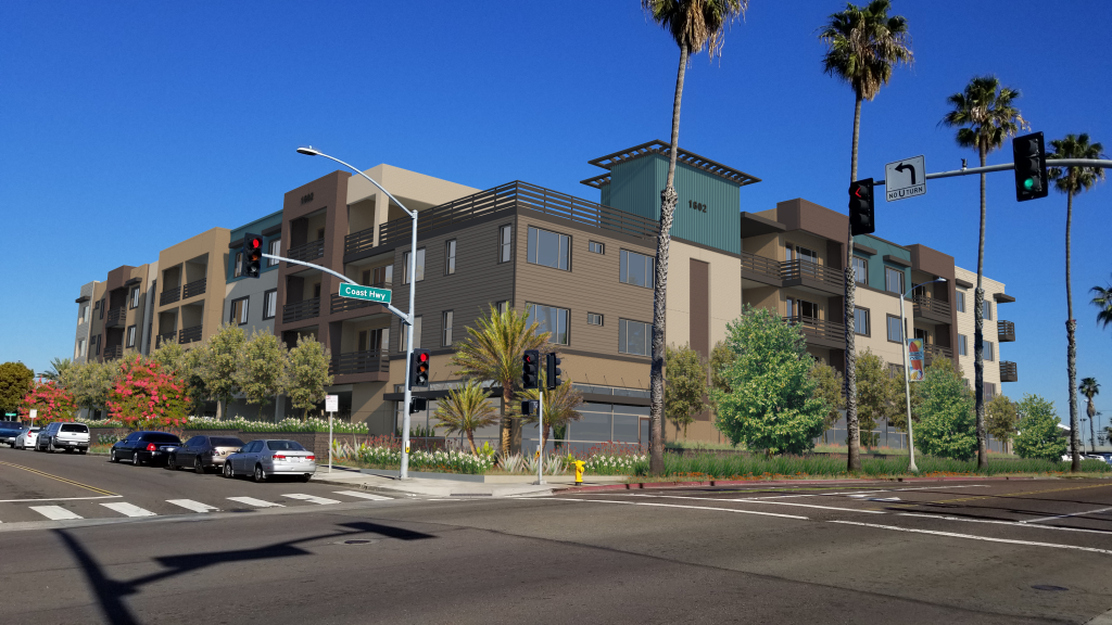
This push to destroy community opposition — through the Manhattanization of suburbia— is epitomized by the SB50, proposed by state Sen. Scott Wiener (D-San Francisco). The bill (currently on hold) could force the city to allow 85‘ residential towers next to Sprinter stations (including Coast Highway @ Oceanside Blvd, and Crouch @ Oceanside Blvd.) But it is also reflected in other state-mandated increases in housing density (claimed to facilitate affordable housing) by forcing accessory dwelling units (ADUs) everywhere.

The California Globe reported Saturday:

Many California lawmaker plans to increase the number of high-density building to alleviate the housing crisis have lost much support in the last month due to the effects of COVID-19 coronavirus in populated areas.

“We’ve seen the reports of buildings in New York that have been flooded with people infected by the coronavirus because of how many people were inside,” explained Dr. Arthur Chatterjee, a housing density expert who has been monitoring the number of coronavirus cases in dense buildings in the US, UK, and India. “It’s what led to higher numbers in Iran as well. And we’ve been finding them to be time bombs inside each one.”

“Door handles are touches, lift buttons are pushed, people pass by closely, live next to each other closely, and also share things such as laundry facilities. In a public area, with precautions, it’s spread much more thinly if it all. But in a flat or an apartment complex, we’ve seen story after story like that.”

“California dodged a huge bullet. If they had them, cities like San Francisco and Los Angeles might have been like New York by now. We’ve all seen the curves by this point. Buildings with a lot of people have been a large factor in that.”

As the New York Times put it, ‘Density is really an enemy’ in situations like this. And experts agree that California’s spread and lower density buildings helped diminish the coronavirus spread.

“Out here, we’re spread out,” said Dr. Lee Riley, professor of infectious diseases at the University of California Berkeley in an interview. “People use cars, the public transportation system is terrible. Whereas in New York City, you have the subways, the buses, Times Square, people living in your small apartment buildings.”

Proposed density bills in the California legislature such as the recently defeated SB 50 and the new housing density bill SB 902 have also been criticized by disease experts.

“Like I said before, you really dodged a bullet there,” continued Dr. Chatterjee. “If these had been in effect and those buildings were built, cases would be up. I cannot give you an estimate, but based on the fact that they would draw poorer people, who are much more likely to use public transportation and who have been hit particularly hard by Coronavirus, California would have had a lot more deaths by now and would be on track for a New York level of crisis.”

“I understand you have a housing crisis, but these are very disturbing ‘what if’ scenarios here. I agree you need more housing, but these are contagion traps in what was proposed here. I’d be shocked if people still thought this would be a food idea moving forward.”

The story continues

“We’ve lost about half of our members since St. Patrick’s Day,” lamented Carlos Gomez Ochoa, who leads a Los Angeles group to pass denser-housing laws. “It’s not that they are out with the coronavirus. They’ve seen what the coronavirus has been doing to buildings we held up as models of what should be built.”

“One of our members has a sister in New York that lives in a high-density, low-cost building that was built only a few years ago. We always used this as to what LA should build.”

“We found out a few days ago that there are dozens of cases in that building alone now. And that’s just one example.”

“A lot of people left because they saw things like that… Every reason has been because of ‘seeing what a disease can do to these places’ or something similar.”

“Our sister group in Oakland saw a 40% drop, and another LA group we share things with is debating whether to continue on now because they lost so many members. Everyone is just seeing these denser buildings as death traps for them and their children.”

Oceanside’s Planned Density Increases

At the same time, the idea of increased density is baked into the state polices that have been forced on regional and municipal government. For example, SANDAG (which plans regional transporation funding) has proposed “5 Big Moves” to spend public money on mass transit rather than highways — despite widespread opposition by North County and East County leaders.

Similarly, in the General Plan update nearing completion, the City of Oceanside is proposing mandating higher density and transit use in the city to meet state “Climate Action” goals. Under the euphemism “Smart Growth”, the new General Plan would mandate higher density, as page 3-25 of the April 2019 “Climate Action Plan” summarized:

The term “smart growth” refers to a compact, efficient, and environmentally sensitive urban development pattern. Smart growth focuses future growth and infill development close to employment, services, and public facilities to maximize the use of existing infrastructure and preserve open space and natural resources. Smart growth is characterized by more compact, higher density development in urbanized areas throughout the region.

SANDAG performed previous studies of land use, housing, employment, and transit system densities to identify seven types of Smart Growth Opportunity Areas (SGOA) throughout the County of San Diego. Types of SGOAs include metropolitan centers, urban centers, town centers, community centers, rural villages, mixed-use transit corridors, and special use centers. Existing SGOAs within Oceanside include:

  • The town center generally located north of Seagaze Drive, south of Harbor Drive, and west of Interstate 5;
  • The mixed-use transit corridor along South Coast Highway between Mission Avenue and the Buena Vista Lagoon (west of Ditmar Street and east of the North County Transit District [NCTD] Coaster line); and
  • The mixed-use transit corridor along Oceanside Boulevard between Interstate 5 and Canyon Drive.

SANDAG’s Smart Growth Concept Map also identifies three potential SGOAs in Oceanside:

  • A community center centered within 1⁄4-mile of the intersection of Oceanside Boulevard and El
    Camino Real;
  • The community center centered within 1⁄4-mile of the intersection of Oceanside Boulevard and Rancho Del Oro Drive; and
  • The community center centered within 1⁄4-mile of the intersection of Oceanside Boulevard and Melrose Drive.

(The last three locations are tied to nearby Sprinter stations.)

After the the council’s rejection of the Coast Highway density increases south of Morse Street last summer, we believe the description of the Coast Highway SGOA is now obsolete. At a minimum, the city should modify the description to define this SGOA as being between Mission and Morse Street.

More generally, the city needs to re-evaluate whether NYC-style (or even SF- or SD-style) density increases are appropriate for a low-density suburban community tyat

Comments on the propose Climate Action Plan of the General Plan update can be submitted to Russ Cunningham, ideally by April 6.