Progress on saving Oceanside beaches

One definition of insanity is doing the same thing over and over and expecting a different result. Fortunately, when it comes to Oceanside’s disappearing beaches, the city of Oceanside is finally doing something different.

That something different is called Rebeach — a coastal preservation design competition — and the first efforts were on display in a workshop Tuesday at the city council chambers. The three hour workshop include an 88 minute presentation that has been uploaded to YouTube; the city is accepting public feedback through September 30 — and also invites resident to attend the October 17 and December 13 workshops.

How We Got Here

A lack of sand is a problem for much of the Oceanside Littoral Cell that extends from Dana Point to La Jolla, including Oceanside. The issues are summarized by Save Oceanside Sand, a community advocacy group.

Since 2001, Oceanside and other government agencies have funded various efforts at sand replenishment i.e. dredging up sand and depositing it on city beaches. These efforts have emphasized the beaches near the Pier, and only rarely made it south of Wisconsin Street. Even so, the amount of sand remaining on these beaches today seems below the average during this period.

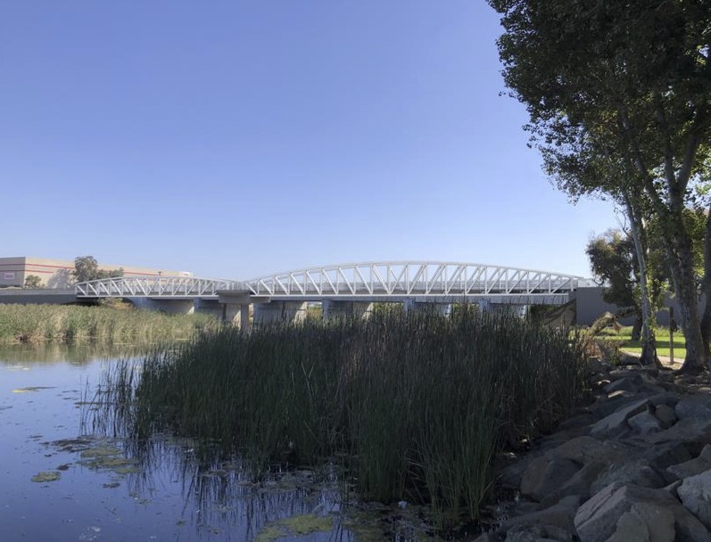
Compared to the tourist-serving beaches, South O beaches have suffered even more. Those of us who have lived in Oceanside for decades recall when Buccaneer and even Cassidy Street beaches had sand. Now we hobble over the cobble (muffin-sized rocks) to get into the Pacific, which discourages all but the most determined from venturing into the water.

The city and others in the county have spent the past decades blaming the Marine Corps for building the Del Mar Boat Basin in 1942 and thus blocking the southbound transport of sand along the beaches. Efforts by one (or even two) of 435 congressional representatives to force the US government to fix the problem have been (predictably) unsuccessful.

Meanwhile, the Army Corps of Engineers concluded that the city’s harbor contributed to the problem. Despite years of study, there are conflicting theories about the most important (and relative impact) of possible contributing factors — which, in addition to lateral transport of sand, might also include currents drawing sand offshore (or failing to return onshore).

The past 22 years have demonstrated that replenishment without retention matches the aforementioned definition of insanity. The Rebeach competition is intended to generate retention solutions that are scientifically, economically and politically feasible.

Rebeach Oceanside

In January, the city approved creating the Rebeach design competition, and promised to advertise the competition globally. The stated mission of the competition is “To construct an innovative, multi-benefit, sand retention project on the City of Oceanside’s beaches that serves both local and regional benefits” while the criteria include:

  • Align with the community character and history of place within the City of Oceanside.
  • Leverage previous analysis and feasibility studies completed to-date.
  • Maintain a forward-thinking design that incorporates adaptive capacity of solutions to future coastal conditions while addressing chronic erosion issues.
  • Be technically feasible, financially viable, and environmentally and socially acceptable.

In May, the city announced the 15-member selection jury. Later that month, the jury selected three design teams, which have been working with the city since then. The three teams were announced on August 1.

August 29 Workshop

On Tuesday, the city’s project committee introduced the three finalists, which each made a 20 minutes presentation about the ideas they developed over the past three months.  The workshop attracted a standing room only crowd of more than 200 people — the most I’ve ever seen in the council chambers.

The three teams were (in order of presentation):

  1. Deltares (from Delft, Netherlands), Deltares USA (Silver Spring, MD) and the architectural firm MVRDV (Rotterdam). Three representatives discussed the various tradeoffs, provided examples from around the world, and promised to select from a catalog of previously successful coastal engineering approach. Among their three concept designs was building out a “green dream peninsula” at Buccaneer Beach to aid in sand retention.
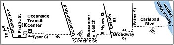
  2. SCAPE Landscape Architecture (New York) with its earlier partner, the nonprofit Dredge Research Collaborative and the engineering firm ESA (Florence, Italy). The entire presentation was by a landscape architect from SCAPE’s San Francisco office. The presentation include converting Tyson Street beach into a “Dunepark” and building a “Cobble Crest” and “Nearshore Reef” at Buccaneer.
  3. International Coastal Management, a 34-year-old coastal engineering firm based on Australia’s Gold Coast near Brisbane. The firm was represented by its third most senior engineer, who emphasized the similarity of the beach preservation issues of California and the Gold Coast, including the importance of working with the surfing community. He presented more general ideas for sandbars and reefs.
Design concept for Buccaneer Beach by Deltares
Design concept for Buccaneer Beach by SCAPE Landscape Architecture.

The public had a chance to meet with the firms before and after the public presentation, but the city emphasized its desire to obtain public input using its formal online survey process.

Process and Key Players

Introducing Tuesday’s session were two key members of the city’s five-member project committee. One was Sam Carter from Resilient Cities Catalyst, a nonprofit consulting firm that is running the design competition, and has run more than 60 projects for local governments. It helped launch the San Diego Region Coastal Exchange to discuss issues such as coastal erosion.

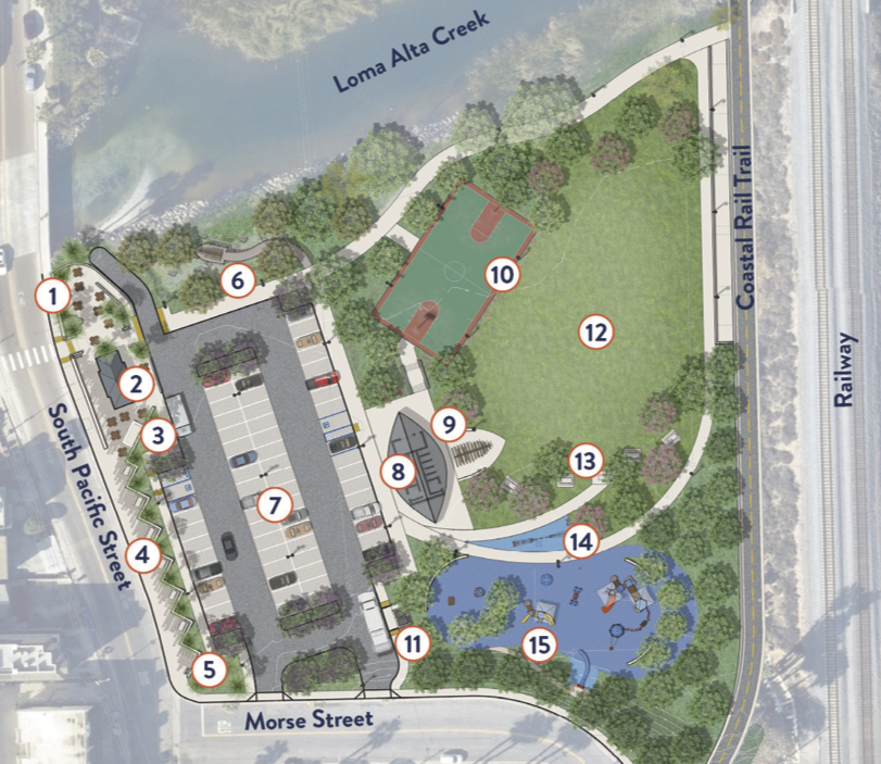
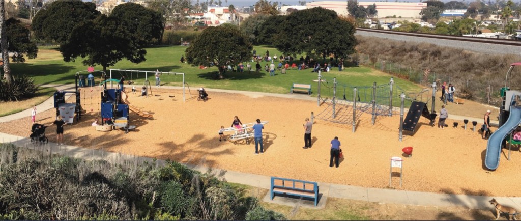
The other was Jayme Timberlake, who for the past 16 months has been the city’s (First ever) Coastal Zone Administrator. In addition to beach erosion, she’s also involved in the Buccaneer Park refurbishment. The other three committee members represent RCC and GHD, a 95-year-old Melbourne-based engineering design company with more than 200 global locations, including 13 in California.

The decision of the council (and the city manager) to hire a full-time staffer to handle coastal issues — and start the competition — suggests that our city (unlike many other SD cities) is no longer doing the same thing and expecting different results. In addition to the city manager, Mayor Sanchez and two councilmen (Keim, Weiss) attended Tuesday’s session.

The jury has 15 members, five of whom are nonvoting. It includes five PhDs, one current and two former staffers of the California Coastal Commission, two coastal engineers and a marine biologist. Community representation includes four Oceanside residents: the heads of the local Audubon Society, the Chamber of Commerce, a charter boat company and Save Oceanside Sand, while a fifth public member (a director of Oceanside Boardriders) is also a city resident.

Among the 10 voting members are two councilmen, from Del Mar and Encinitas.  However — perhaps as a testimonial to coastal insanity — Carlsbad has repeatedly criticized Oceanside for not collaborating but refused an invitation to collaborate in the jury process.

Going Forward

The plan is for the three teams to refine their ideas and present them two more workshops set for October 17 and December 13 (dates subject to change).

The schedule in the city’s April 26 guidelines concludes with the following dates:

  • December 18: “Jury selects one preferred option to bring to City Council”
  • January 1: “Consistency Review: GHD conducts consistency review of preferred design”
  • January 22: “City Council Vote: preferred Design Team should be in-person”

The city’s guidelines state

Upon a passing vote, the winning design will move directly into final engineering and environmental compliance phases, with the GHD team. What sets this process apart from other, more traditional design competition processes, is its direct link to the engineering design and permitting phases for construction. The ultimate outcome of this process will be a shovel ready sand retention pilot project.

There are many opportunities for public participation in the next three months. Given how important the beach is to our community and our city, South O residents should avail themselves of every opportunity to provide input that influences the city’s eventual decision.

Upgrading the South O rail trail

When completed, the Coastal Rail Trail will provide a Class 1 (fully separated) bikeway parallel to the NCTD line from the Oceanside Transit Center to the Carlsbad city limits. The trail currently stops at Oceanside Blvd., but the city has started design work on

  1. crossing Loma Alta Creek at Buccaneer Park, completing the trail from Oceanside Blvd. to Morse.
  2. replacing the substandard trail from Morse to Vista Way: the original trail built in 2003-2005 was only 8′ wide, instead of the 15′ standard on newer segments of the trail in Oceanside. The wider width is necessary to allow bidirectional travel and a mix of cyclists and pedestrian use.
  3. connecting south from Vista Way to the city limits; the current trail along Broadway dumps cyclists out on the street at Vista Way.
The planned Loma Alta Creek segment (#1) is the dotted green line, and existing South O trail (#2) is the solid green line.

Finishing (and upgrading) this rail trail has been a top priority for Save South O since 2017. This will be on the agenda for the July 25 South O community meeting (6:00-7:15pm at the Moose Lodge, 2017 S. Coast Highway).

South O Trail Upgrade

For #2 and #3 (the South O upgrade), council approved starting the alignment study in February, and work has begun on gathering public input to shape that design. There are two immediate opportunities for South O to make its voice heard in this process. See also the city’s Coastal Rail Trail website for future updates.

August 7 Workshop

On Monday August 7, the city is holding a 6:00-8:00 pm workshop at the Civic Center Library downtown. The city and its consultants will provide an update on the project, and it will be a time that South O (and other residents) can ask questions questions of both.

This is the first of two planned workshops (the other in February/March 2024) before the consultants unveil their proposed alignment in the summer of 2024.

Online Survey

To understand what Oceanside, Carlsbad and other residents want for the the South O upgrade, the city has posted a 14 question survey at http://bit.ly/OceansideCRT If you fill out the survey before August 7, you will both know the questions the consultants are asking and also influence their thinking at the event.

When you fill out the survey, here are two observations.

  • The survey doesn’t distinguish between South O and other 92054 residents. You should indicate in the remarks that you live in South O.
  • When I joined a group in taking the survey, the six categories for Q6 (“What are your top priorities”) was confusing. Some clarification of these categories:
    • Access & Mobility refers to the part of the trip when you are not on the trail (e.g., if you bike to the harbor, the part from your home to the trail and the part from the end of the trail to the harbor).
    • Equity is a two-part question, a general one about “serving all trail users”, and a specific one about “historically underserved populations.”
    • Feasibility & Timeline is asking if you are willing to give up some of your lower priorities to get the trail made sooner.
    • Safety was the only question that seemed clear to everyone.
    • Sustainability was also clear to most, when it refers to “environmentally sustainable design practices.”
    • Trail Experience refers both to whether you will enjoy using the trail, and also if the trail is attractive enough to others so they will use the trail.

The alignment study will decide several questions about the preferred path through South O, which is not necessarily the same as the current trail. One key question is how the trail will connect from Eaton to the Coast Highway bike trail, since the Buena Vista Audubon Society has rejected the city’s request to have the trail connect south of Eaton using their lagoon property. Also, although the bulk of the trail (segment #2) is expected to utilize NCTD right of way, the question remains where exactly the trail will be placed along Myers and/or Broadway.

Finally, since the northern trail is west of the train tracks and the city’s southern terminus is west of the tracks, a key question is how does the trail cross the tracks? The options seem to be

  • Continue to cross the tracks at the existing Cassidy Street grade crossing;
  • Cross the tracks south of Cassidy Street, either under or over the tracks; or
  • Cross the tracks north of Cassidy Street, either under or over the tracks.

Crossing Loma Alta Creek

Today, the current CRT goes from the Oceanside Transit Center south to Oceanside Blvd. There is no connection from Oceanside Blvd. to the existing (narrow) ”rail trail” that begins at Morse St., between Myers and the NCTD tracks.

The city has approved connecting these two segments with a 255′ long bridge over Loma Alta Creek, starting to the existing trail at the south end of Buccaneer Park, and extending north from the bridge to Oceanside Blvd. The trail would be 14’ wide — 10’ paved, with 2’ of shoulder on each side (all paved on the bridge).

In May 2022 the total project cost was estimated at nearly $11 million, with 80% of that coming from a hoped-for grant from Caltrans. The state rejected the city’s first application, but the city is still seeking to eventually obtain state funding.

Buccaneer Park Workshop Thursday

This Thursday at 6pm in the Community Room of the downtown library, the City will unveil its latest thinking on the “Buccaneer Park Re-visioning.” There are a few problems:

  • The meeting is scheduled against the weekly Sunset Market (5-9pm), so parking will likely be difficult.
  • One of the two plans is unsafe, something that the consultants and the city didn’t notice before drafts were shared with South O reps this week.
  • The proposal says nothing about how the revised park will connect to new parkland on the site of the (soon to be closed) La Salina treatment plant — the whole point of Save South O’s repeated calls for a Buccaneer Park master plan.

Still, the proposal give the community a chance to see the city’s thinking and offer feedback for the existing Buccaneer footprint east of Pacific and south of Loma Alta Creek.

Reject Concept #2

The consultant prepared two concept proposals. Save South O recommend immediate rejection of Concept #2, because it moves the playground (for 2-5 and 5-12 year-olds) next to Pacific Street. Any parent who’s lost track of their child for 30 seconds — or watched a kid chase a ball into the street — would understand why this is an unnecessarily dangerous plan for exactly those families it intends to serve. It is inexplicable that this idea has gotten this far without someone calling out the potential risk.

Concept #1

Below are the “Concept #1” plan, along with an aerial view of the existing park

The major changes

  • Moving the restroom from the west to east side of the parking lot
  • Expanded/reworking of the playground area
  • Some additional space around the concessionaire (Buccaneer Cafe).
  • Space at the east end of the park to connect to the final segment of the Rail Trail currently being planned.

Some potentially controversial choices (based on informal discussions):

  • No more shower in the bathroom. The city could have a shower inside, a shower outside, or no shower (relying on the existing shower on the beach to shower off).
  • The option (during busy times) to move the coffee cart away from the Cafe.
  • The addition of a basketball court reduces the existing park area.

The city has a series of questions about the proposed design.

Begging the Question

Save South O has been pushing the city since 2019 to reveal the complete picture of what is going on around Buccaneer Beach and Park. This workshop

  • Does not show reuse for the La Salina plant. Our consistent position has been that South O needs to know what uses are planned for north of Loma Alta Creek before rebuilding the existing park. (For example, basketball, tennis or pickleball are separate uses not tied to the existing beach or picnic area that would make more sense in the La Salina location).
  • Does not show the Creek restoration (where the city already has a grant)
  • Does not show the rail trail (although it leaves room for it)

The Save South O recommendation: the city should hold off implementation of any Buccaneer Park redesign until it can share a complete vision for all of Buccaneer Park—including any expansion until the former La Salina plant.

Participating in Buc and other South O decisions

Here are several key opportunities to South O residents to participate in several key decisions regarding Buccaneer and several other key area of community:

  1. 8:30am July 31: next meeting of Save Oceanside Sand
  2. No later than July 31: Deadline to respond to the City’s official survey regarding the future of Buccaneer Park.
  3. 6:00-7:30pm Aug. 3: initial meeting of Advisory Committee (in Council Chambers or via Zoom) for planning the Beachfront Improvement Project around the Pier.
  4. By 6pm Aug. 6 (South O residents only): deadline for a one-question survey regarding the priorities for community reuse of NCTD land between Cassidy and Morse: either a beach trail or expanded parking.
  5. 2pm Aug. 11: City Council Workshop on Feasibility Study for Beach Sand Replenishment/Retention

Finally, on a lighter note, the 8th Annual South O Car/Boat/Bike Show is being held 9am-3pm Aug. 28 as a fundraiser for South O Elementary. To register or for more information, see http://socalcarculture.com/events.html

Attend Buccaneer Park Workshops: July 10, 22

Save South O has been pushing for more than two years to have the city provide a holistic plan of the various projects plan around and near Buccaneer Park:

  1. Completing the rail trail across Loma Alta Creek
  2. The Loma Alta Creek restoration project, including creation of a pedestrian trail on the north side of the creek
  3. Upgrading the bathrooms/restaurant building that serves Buccaneer Beach and Park
  4. Redevelopment of the unused 7 acres freed up by the planned closure of the La Salina Wastewater Treatment Plant

In particular, the city has (repeatedly) refused to commit to using all (or even some) of the WWTP land for parkland, even though both parkland (and parking for visitors to use the park) need to be expanded.

Representatives of Save South O met with Park & Rec staff, the city manager, and council members arguing that the city needs to develop a master plan before building anything at the site. The development of the site (like other projects) was slowed down due to COVID-19, allowing the planning process to catch up with the schedule for these various projects.

Update: The city has posted a survey about existing and future uses of the park. We encourage South O residents to push to expand Buccaneer Park using the land freed up by the closure of the WWTP.

The city has now committed to hold two public hearings about plans for the future of Buccaneer:

Workshop #1:

Date: Saturday, July 10th
Time: 10am – 2pm
Location: Buccaneer Park – 1506 S. Pacific Street, Oceanside, CA 92054

Workshop #2:

Date: Thursday, July 22nd
Time: 9am-1pm
Location: Main Street Farmer’s Market – Corner of Coast Highway and Pier View Way

We encourage South O residents to turn out en masse at these meetings to advocate both for expanding Buccaneer Park, and for a design that maximizes the availability for park land for use by South O and the community more generally.

Finishing the Rail Trail — the right way

On Thursday, October 29 the city will hold an online webinar to discuss plans to finish the “Rail Trail” over Loma Alta Creek. The city is discussing building the final missing link, from Oceanside Blvd. to Morse St., thus connecting the Oceanside Transit Center to the city’s southern border at Buena Vista Lagoon.

The webinar will be held from 5-6pm, using GoToMeeting or a call in number:

The Future of Buccaneer Park

The changes at Buccaneer over the next few years will permanently change the park, the neighborhood and South O. The rail trail is one of four projects at Buccaneer that Save South O is carefully monitoring:

  1. Restoration of the Loma Alta Slough
  2. Completing the rail trail with a new bridge over Loma Alta Creek
  3. Repairing/replacing the Buccaneer Park restrooms
  4. Redeveloping the La Salina Wastewater Treatment Plant

#3 and #4 have been designed although no noticed public hearings have been held.

Restoration of the Loma Alta Slough

#1 and #2 have external funding and are closest to completion. They are directly related because the trail along the Slough will pass under the rail trail bridge, and connect to the rail trail on the North side of the Slough.

At its Sept. 17 public webinar, the city discussed its site plan for the restoration project. Below is the diagram the city presented (Alternative 1) how the Slough trail (in gray) connected to the proposed “Rail Trail” (pink).

Completing the Rail Trail

Next week’s hearing will discuss the latest segment, which is billed as the final leg in Oceanside of the “44-mile bike trail between the City of Oceanside and the City of San Diego.” .

The trail was/is being built in four legs, beginning with South O:

  1. From the city limits to Morse Street — East of the tracks south of Cassidy, and West of the tracks north of Cassidy — which was finished in 2004.
  2. From Morse Street to Oceanside Blvd. (West of the tracks) — the subject of the current plans
  3. From Oceanside Blvd. to Wisconsin Street — completed in 2014
  4. From Wisconsin Street to the Transit Center — completed in 2013

However, parts of this trail — both existing and planned — are not suitable for serious bicyclists. Here we concur with earlier efforts by the Oceanside Bicycle and Pedestrian Committee to build all legs at a width suitable for high-speed cyclists to pass in opposing directions.

Map of Oceanside Rail Trail (bypassing leg #2) from the San Diego Reader (Sept. 4, 2019)

Putting Actual Bicycles on the “Bike Trail”

The key issue is the trail width. While the northern legs are a proper width, the original leg is not wide enough for cyclists (let alone cyclists and pedestrians) — nor is the planned leg along Loma Alta Creek.

Here is the newest leg at north side of Oceanside Blvd. where it is nearly 11′ wide (15.8′ with the concrete shoulders):

while here is the original leg where it crosses Whaley Street, where the asphalt is 7’ wide (8’ with shoulders):

After making its original mistake, the city now realizes that all remaining legs must be built to national bike path width specifications. In fact, in September 2017, the city’s (external) design engineers widened the planned trail over Loma Alta Creek from 12 to 14 feet at the request of the Bicycle and Pedestrian Committee. See Appendix F of the city’s Rail Trail Project Study Report (October 2017).

However — according to last month’s public webinar — the Loma Alta Creek trail is planned to be 6’ wide; this is closer to a standard sidewalk (5’) than than national standards or the remainder of the trail.

Save South O’s Position

Below is the letter that Save South O sent this week to the Loma Alta Creek project manager, arguing that when the city builds the Loma Alta Creek trail, it needs to be built at a proper width.

Subject: Correcting plans for trail along Loma Alta Slough
From: Save South O
Date: 10/22/20, 4:08 PM
To: Justin Gamble

Dear Justin,

Thank you again for hosting the meeting last month to update South O on plans for the Loma Alta Slough restoration project. I wanted to follow up on one point that came up during the hearing.

Regarding the trail planned to connect Coast Hwy to the Rail Trail and Pacific St.: when I asked how wide it would be, I was told 6′. This is a reasonable width for pedestrian only traffic, as our sidewalks are typically 5′ wide.

However, it is inadequate for a Class I bike path, let alone for a path intended to combine pedestrian and bicycle traffic as the sole crossing between Cassidy and Oceanside Blvd. For example, the southern end of the existing bike trail (at Oceanside Blvd) is 130″ wide, plus two concrete shoulders of 30″ for a total of 190″ (15′ 10″).

As attached, the city’s own analysis (made by Dokken in September 2017 for the Oct 2017 rail trail report) rejected a 12′ trail width as inadequate. Instead, it widened the bridge over Loma Alta Creek to 14′ to accommodate an expected mix of bicycle and pedestrian traffic. Quoting from the memo:

The AASHTO Bike Guide … recommends wider paths of 11 feet to 14 feet if:

  • Pedestrians comprise 30% or more of path traffic,
  • The total volume of path users (all types) in the peak hour exceeds 300, or
  • There is significant use by in-line skaters, children or trike riders.

Meanwhile, the “bike path” built 15 years ago between Eaton and Morse is only 7′ wide (8′ with shoulders) and is effectively a sidewalk, used by pedestrians, strollers, and families with children. Adult bicyclists do not use the path because it is not wide enough for cyclists to pass at normal speeds, even if there are no pedestrians or children on the path.

To avoid wasting money as was done on the first leg of the rail trail, I ask the city to revise its plans for a trail along Loma Alta Creek to use a width consistent with to the newer (Oceanside Blvd) segment of the rail trail, the bridge over Loma Alta Creek, and the AASHTO guidelines quoted by the city’s October 2017 Project Study Report.

Joel

Council should delay Buccaneer decision to next month

At Wednesday’s council meeting (Item #9), the city is planning to allocate $449,150 to spend on designing the Rail Trail over Loma Alta Creek. (Technically, the council is voting on approving spending up to $100k of city money to go with a $400k SANDAG grant).

While Save South O has for years advocated completing the rail trail for many years, we are strongly opposed to this being approved this month. We have three reasons: budget, transparency and public participation.

To resolve these issues, we ask that the city postpone this item 2-4 weeks (until its April 8 or April 22 meeting) so these issues can be addressed. We ask that you email the council to support this postponement, and send the same information to the city clerk.

1. Budget Uncertainties

The city, state, country and world are in uncharted territory with the economic dislocations created by efforts to fight COVID-19. While health officials can learn from earlier pandemics, economists don’t know the impact of widespread suspension of business by California and other states.

In 2019-2020, 64% of the city’s revenues come from four sources: property tax, hotel (TOT) tax, and regular and Prop X sales tax. These total $110.91m of the $173.48m budget, or 64%.

Oside Budget 18-20

We can expect that hotel, bar and sit-down restaurant revenues will nearly zero as long as the state mandated shutdowns (which began March 15) continue. The most optimistic predictions have life returning to normal in April or May, but on Saturday the county’s health department said county residents should be prepared for the shutdown to last 3-4 months, i.e. into July. In addition, many workers laid off from these businesses will be struggling to make basic purchases like food or housing (neither of which generate sales tax), let alone dining out or shopping for cars, clothes or consumer electronics (which are taxed).

Second, the city’s budget for next year assumes a 7.9% increase in property tax revenues. Some of that would come from new properties, but other aspects depend on increases in property valuation. With the stock market falling by one-third (so far) in the past month — and the newly laid off workers — residential prices are likely to fall as they did in 2006-2011 (even if not as far). The likely bankruptcy of retail businesses will also hurt commercial property tax revenues.

Oside Budget 20-25

All considered, it seems likely that the city will have a $5-15m shortfall in calendar 2020, i.e. the last 4 months of 19-20 and the first 6 months of 20-21.

The city is considering promising up to $100k (20% match to SANDAG’s $400k grant) for this work. The prudent thing to do is to wait a few weeks so that the finance staff can prepare revised budget projections based on the dramatic change in the local economic conditions.

2a. Transparency on Buccaneer

In the past 10 months, Save South O has been trying to get the city to show all its cards on plans for Buccaneer.  It has five projects in various stages of completion:

  1. The rail trail across the east side of the park
  2. Restoring Loma Alta Creek
  3. Replacing the bathrooms
  4. Building a lift station to replace the La Salina Wastewater Treatment Plant
  5. Repurposing the remaining 7 acres of La Salina for condos, a hotel, parkland, or something else

We have met with the respective project managers, city official, and three members of the council. The city still refuses to provide a master plan for these five Buccaneer projects — a map and schedule — show how all of these impact each other. For example, whether the bathroom (or lift station) is built may become obsolete if later uses on the rest of the park mean it’s blocking public access to part of the park. This plan for the Buccaneer area needs to be made consistent with the city’s new Parks and Recreation Master Plan approved by the city in Fall 2019.

We do not believe it’s fiscally prudent to continue spending until these issues are resolved. Save South O will continue to testify against spending any money on planning or implementing permanent improvements at Buccaneer until the city shows the public how all the pieces fit together.

2b. Transparency on the Rail Trail

The city held a public “information meeting” on May 13, 2017 for the rail trail at Buccaneer Park, and has not held a notice public hearing on the design. However, while  the city last updated its project disclosures on its website in October 2017, it has since been sharing information with specific interest groups — which may or may not be the same as was posted in 2017. But the 2017 drawings show the trail will cut off the easternmost stripof the existing park, with no plan to replace that lost acreage.

CRT Final PSR_2017-10-12-p21-100dpi
Dokken Engineering, Project Study Report, October 2017, p. 21

CRT Final PSR_2017-10-12-p28-29
Composite of 2017 Project Study Report, pp. 28-29

None of this information is in the staff packet. The city knows what it wants Dokken do, but a) this is not in the packet b) the city has not held a noticed public hearing on this project since March 14, 2018 (when it voted to apply for the SANDAG grant).

Therefore, we ask the council to postpone allocating the funds until there is a public hearing on the status of the project and future plans.

3. Public Input

Wednesday will be the city’s first full council meeting since the COVID-19 crisis, under new rules that ban in-person participation by the public (in response to state mandates).

The city has put into place new rules for public participation:

Due to applicable Public Health Orders issued by the County Health Officer, the City Council chambers will not be open to the public and City Council members have the option of participating telephonically. Members of the public are strongly encouraged to watch the meeting on KOCT Cox Channel 19 (live streaming service available at www.koct.org/channel-19) and provide written comments on agenda items via email at cityclerk@oceansideca.org .Comments will be received until the Mayor calls the item. All timely received comments will be provided to the City Council.

Members of the public may also provide telephonic comments on each agenda item. In order to provide a telephonic comment, members of the public may call (760) 435-5999. When prompted, the caller should identify the agenda item they wish to speak about and leave a message not to exceed three minutes. All timely received telephonic comments will be shared with the members of the City Council and will be made publicly available at on the city’s webpage at http://www.ci.oceanside.ca.us/gov/council/ac.asp The deadline to leave a telephonic comment is noon on March 25, 2020.

For the first meeting, it is not clear how these policies will work. Will any of them be included in the public broadcast of the hearing? Will every council member hear every comment and read every written submission, the way that in person public testimony is heard?

Therefore, we ask that this item be postponed at least one session so the public can understand how the new process will work.

4. Enough Slack to Make the Change

The city staff may argue that the item cannot be postponed, because it’s tied to the $400k SANDAG grant that expires June 13, 2021. There are several reasons why this does not prevent a 2- or 4-week continuance of this item:

  • The current executive director of SANDAG has made alternative transportation a priority, and thus wants cities to build projects that promote bicycle use.
  • The last schedule task in the contract ends May 3, 2021 — 41 days (almost 6 weeks) before the grant ends. A 2- or 4-week delay is not going to prevent finishing on time
  • Oceanside is not the only SANDAG city facing severe economic dislocation, with unexpected public safety costs, widespread layoffs and wide swath of businesses at risk of bankruptcy. If Oceanside needs a one- or two-month contract extension so that this spring it can make more prudent long-term decisions, it seems as though it will not be alone in needing extra time.

King tides and the coastal zone

On Friday, the city of Oceanside will be meeting at Buccaneer Beach to discuss the potential impact on the city’s coastline if, as predicted, the sea level rises in coming decades. The state has asked cities to come up with plans to deal with rising sea levels when (or if) they occur. Thus, Oceanside is revising its Local Coastal Program for the first time since 1987.

The city will holding informal discussions along the cost during “King Tides”† forecast for this weekend and next month. Here is what the city announced last month:

The next series of king tides will occur between January 10-12 and February 8-9.  The project team invites you to meet us on the beachfront in January and February to observe the king tides and discuss what king tide events suggest about the potential impacts of future sea level rise.  We will be at Buccaneer Beach on Friday, January 10th at 8:00am and at the public parking lot at Wisconsin Street and The Strand on Sunday, February 9th at 8:30am.  During these gatherings, we welcome your input on those stretches of our coastline most impacted by tidal and storm events, as well as any changes you have witnessed on the beachfront over the past several years.  Please join us!

Although it is a work day for many people, we hope to see Save South O supporters at Buccaneer on Friday.

† The National Oceanic and Atmospheric Administration says “A King Tide is a non-scientific term people often use to describe exceptionally high tides.”

The future of Buccaneer

The future of Buccaneer Park was on the agenda of the South Oceanside Community and Merchants Association. The city has three projects going forward:

  1. Redeveloping the La Salina Wastewater Treatment Plant
  2. Restoration of the Loma Alta Slough
  3. Repairing/replacing the Buccaneer Park restrooms

The first of these three items was the subject of the today’s presentation at Beach Break Cafe, by Lindsay Leahy, principal water engineer of the city’s water utilities department.

IMG_8831-cropped
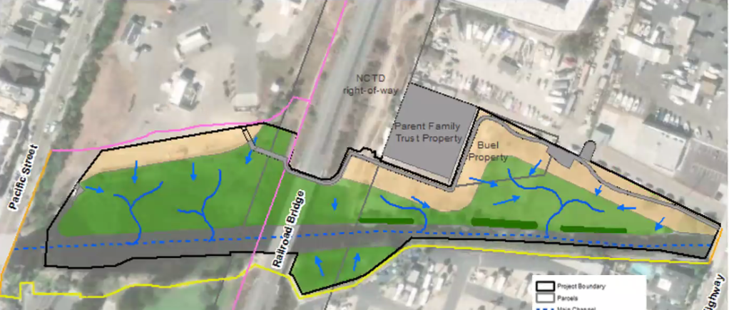
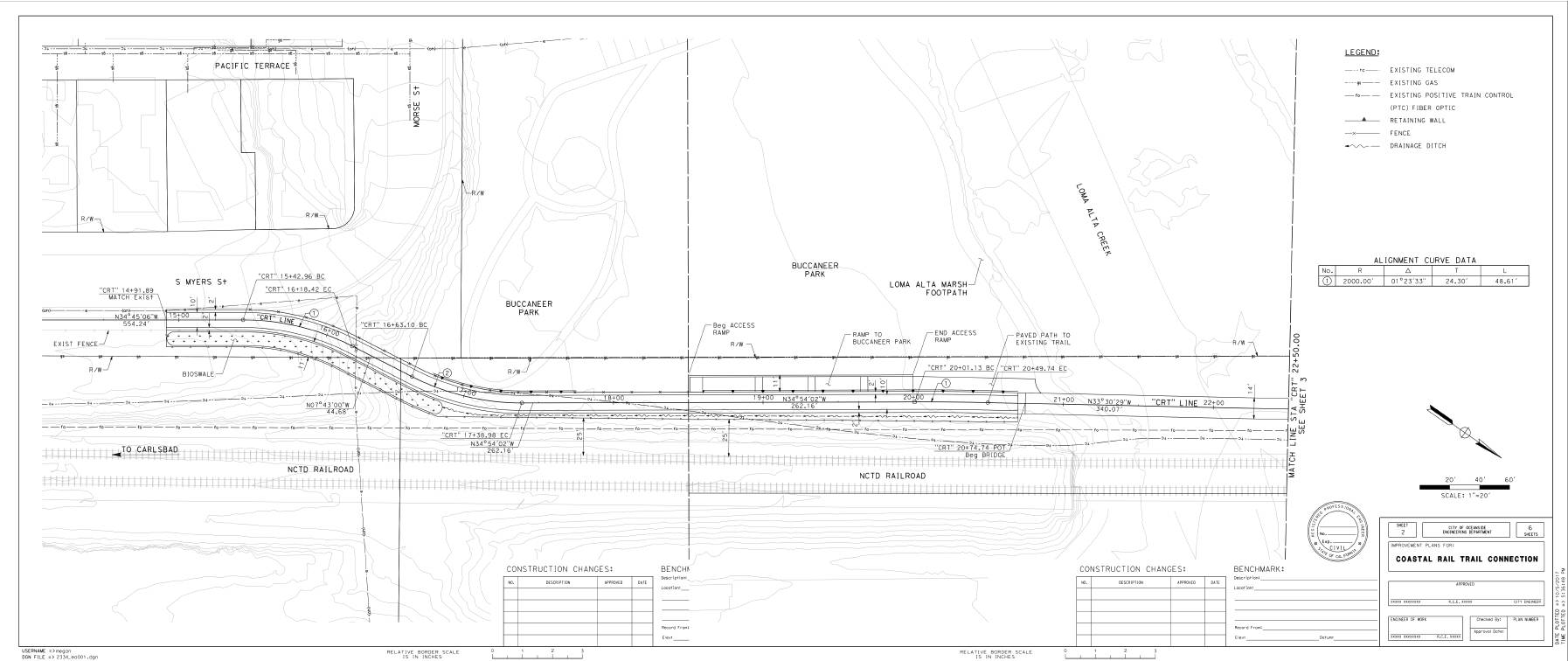
The specific project presented was the decommissioning of the La Salina WWTP. Rather than upgrade the plant built in 1949, the city decided in 2014 to close it. However, closing this requires building a lift station to take all the sewage that flows via gravity to from South O, Fire Mountain and downtown, and pump it back to the San Luis Rey WWTP built in 1972.

This will require building a new return pipe under Oceanside Blvd. to Garrison Blvd. It also requires building a pump station at the La Salina site, and both have to be working before La Salina can be decommissioned in 2022 (perhaps by the end of 2022).

Future of Buccaneer

On the west side, the future of Buccaneer depends on getting sand back on Oceanside beaches. Currently the city is prioritizing sand around the pier over the rest of the city.

However, the La Salina decommissioning will free up 2/3 of the 10.6 acre side, located between the railroad tracks and Pacific St, north of Loma Alta Creek. The current sketches show 66 parking spaces as part of the pump station construction. The city has not announced (or even decided) its plans for the remaining 7 acres.

Loma Alta Wetlands-La Salina 04-2019
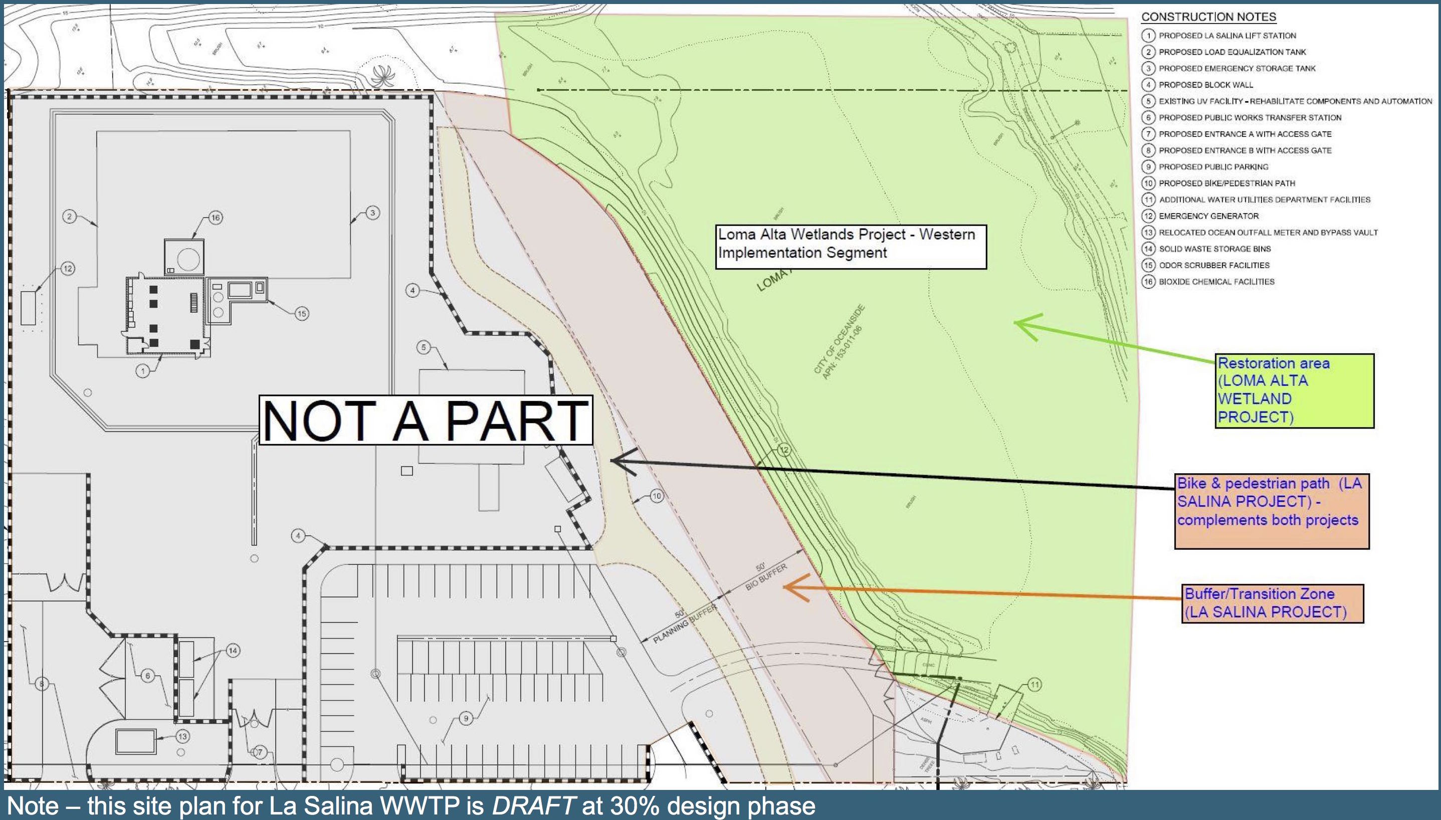
The creek (slough) restoration one of the 100 or so sites being restored by the Southern California Wetlands Recovery Project. In addition to wetlands restoration, it will also include additional walking and/or bike trails along the north side of the creek. The wetlands project is the subject of an August 15 workshop from 5-7 p.m at the downtown library.

Finally, the city is long overdue to fix the decrepit bathrooms at Buccaneer. Leahy said the city will issue an RFP to study this remodeling.

Public input for all three projects will be sought in the remainder of 2019 and throughout 2020. It appears that the use of the unused part of La Salina — crucial to the future of Buccaneer and South O — will be subject of later hearings.

Next step in completing Rail Trail

One of goals of the Coast Highway “road diet” is to make lanes for bicycles. But as California bicycle safety standards make clear, a Class II bike lane is not as desirable (or as safe) as a Class I separated bike path.

The Coastal Rail Trail is a planned 44-mile route from Oceanside to San Diego’s Santa Fe Depot. It is one of the major bicycle priorities for SANDAG and the coastal cities along the route. Oceanside is doing better than most of the county, with most of the stretch completed from the Oceanside Transit Center to the city’s southern border.

TrailLink - Rotated closeup

In April 2005, the city completed a stretch from Vista Way to Morse (along Broadway and then Myers). A second stretch, from Oceanside Blvd. to Tyson St. (the OTC) along the east side of the tracks, was built from 2012-2015. At the south end of the city, there is a physically separated lane that parallels Coast/Carlsbad Boulevard across Buena Vista Lagoon.

The one gap is the stretch between Morse and Oceanside Boulevard, across Loma Alta Creek. The long-distance cyclists ride on Pacific Street, but between beachgoers and auto traffic, this is hardly optimal — and makes it hard to rejoin the trail at Oceanside Boulevard. Completing this stretch also makes a safer (Class I) path through South O than any Coast Highway bike lane can ever provide: as long as there are cars driving along (and entering and leaving) Coast Highway, these bike lanes will never be as safe as a fully separated bike path.

Completing the trail across the creek has been on the city’s planning radar for several years, and it now appears that the project is once again moving forward. On May 13, the city will hold an open house about the missing segment from 10:00-12:00 noon at Buccaneer Park. The city and its consultant, Dokken Engineering, will be discussing alternative locations for the connecting trail and bridge across the creek, and is inviting cyclists, community members and other interested parties to attend. For more information or to RSVP, see the city’s flyer.